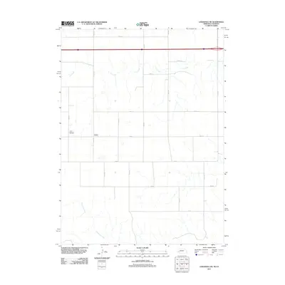
2011 Map of Lodgepole SW
USGS Topo · Published 2011About this map
Czech Slovensky Cemetery and Swankee Cemetery lie within this section of Logan County, providing significant markers for genealogical research in this rural borderland between Colorado and Nebraska. The landscape is defined by an orderly grid of section roads, including north-south routes like Road 139 and Road 143, which navigate the drainage basins of Cow Creek in the north and Cottonwood Creek in the southwest. This 2011 survey captures the area's modern infrastructure, where major transportation corridors intersect the traditional agricultural divisions of the high plains, maintaining the quiet, rural character established by early settlers.
Find a feature on this map
20 named features on this map. Tap any name to fly to it.
Don’t see what you’re looking for? This feature index may not catch every label — zoom into the map to look around manually.
Map Details
Editions of this 2011 Lodgepole SW Map
This is the sole edition of this map. No revisions or reprints were ever made.
Other maps of this area

1899 · Sidney
USGS Topo · 1:125,000

1953 · Twin Buttes
USGS Topo · 1:24,000

1953 · Julesburg Reservoir
USGS Topo · 1:24,000

1953 · Sedgwick
USGS Topo · 1:24,000

1954 · Sterling
USGS Topo · 1:250,000

1954 · Scottsbluff
USGS Topo · 1:250,000

1958 · Scottsbluff
USGS Topo · 1:250,000

1958 · Sterling
USGS Topo · 1:250,000
1971 · Twin Buttes
USGS Topo · 1:24,000

1972 · Lodgepole
USGS Topo · 1:24,000