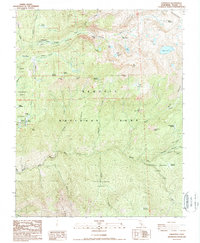
1988 Map of Lodgepole
USGS Topo · Published 1988About this map
The High Sierra backcountry of Sequoia National Park is revealed here as it was surveyed in the 1980s, centering on the recreational and administrative hubs at Lodgepole and Wolverton. This area is characterized by the dramatic transition from the massive sequoia stands of the Giant Forest, including the Congress Group, to the high-elevation alpine basins surrounding Alta Peak and the Tableland. The map documents early park history through landmarks like Tharps Log and the Pear Lake Ranger Station, which serve as waypoints for the trail system traversing Tokopah Valley and the Sevenmile Hill area. Further south, the terrain drops into the drainages of the Middle Fork Kaweah River and Castle Creek, where protected groves like the Redwood Meadow Grove and Castle Creek Grove signify the deep wilderness character of the southern Sierra Nevada.
Find a feature on this map
55 named features on this map. Tap any name to fly to it.
Don’t see what you’re looking for? This feature index may not catch every label — zoom into the map to look around manually.
Map Details
Editions of this 1988 Lodgepole Map
This is the sole edition of this map. No revisions or reprints were ever made.
Other maps of this area

1903 · Tehipite
USGS Topo · 1:125,000

1904 · Kaweah
USGS Topo · 1:125,000

1905 · Tehipite
USGS Topo · 1:125,000

1909 · Kaweah
USGS Topo · 1:125,000

1937 · Kaweah
USGS Topo · 1:125,000

1948 · Fresno
USGS Topo · 1:250,000

1955 · Fresno
USGS Topo · 1:250,000

1956 · Fresno
USGS Topo · 1:250,000

1956 · Giant Forest
USGS Topo · 1:62,500

1956 · Mineral King
USGS Topo · 1:62,500