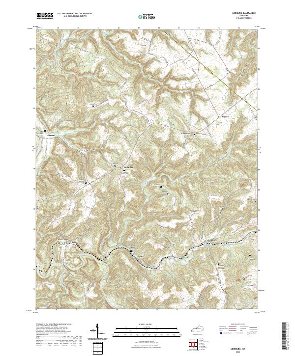
2022 Map of Lodiburg
USGS Topo · Published 2022About this map
Lodiburg and the surrounding ridgetops of Breckinridge County are defined by a network of rural settlements and deep-rooted family landmarks. This landscape is characterized by its numerous small burial grounds and country churches, such as the English Baptist Church near Ammons and the Walnut Grove Baptist Church in the south. The terrain is deeply dissected by drainages like Yellowbank Creek and Sugar-Tree Run, which separate elevated features like Bruner Ridge and Levi Hill.
Find a feature on this map
90 named features on this map. Tap any name to fly to it.
Don’t see what you’re looking for? This feature index may not catch every label — zoom into the map to look around manually.
Map Details
Editions of this 2022 Lodiburg Map
This is the sole edition of this map. No revisions or reprints were ever made.
Other maps of this area

1928 · Hardinsburg
USGS Topo · 1:48,000

1931 · Hardinsburg
USGS Topo · 1:62,500

1934 · Cannelton
USGS Topo · 1:62,500

1947 · Irvington
USGS Topo · 1:24,000

1947 · Lodiburg
USGS Topo · 1:24,000

1947 · Hardinsburg
USGS Topo · 1:24,000

1947 · Garfield
USGS Topo · 1:24,000

1947 · Hardinsburg
USGS Topo · 1:62,500
1950 · New Amsterdam
USGS Topo · 1:24,000

1950 · Alton
USGS Topo · 1:62,500