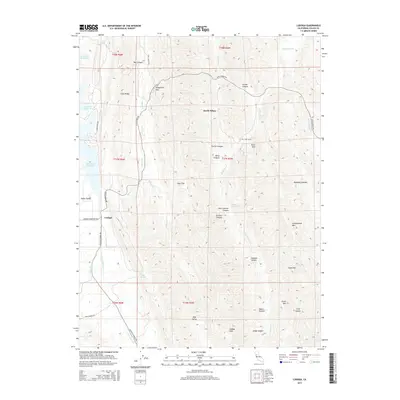
2015 Map of Lodoga
USGS Topo · Published 2015About this map
The settlement of Lodoga sits at the junction of several arterial roads, including Lodoga Stonyford Rd and Leesville Lodoga Rd, serving as a central hub for this corner of Colusa County. The landscape is defined by the massive East Park Reservoir to the northwest and a complex system of drainages such as Squaw Cr and Indian Cr. The terrain is characterized by a series of significant heights, notably Greasewood Mtn, Lodoga Peak, and Pence Mtn, which frame the deep incisions of Scotties Canyon and Hayes Canyon.
Find a feature on this map
47 named features on this map. Tap any name to fly to it.
Don’t see what you’re looking for? This feature index may not catch every label — zoom into the map to look around manually.
Map Details
Editions of this 2015 Lodoga Map
This is the sole edition of this map. No revisions or reprints were ever made.
Other maps of this area

1904 · Logan Creek
USGS Topo · 1:24,000

1904 · Sites
USGS Topo · 1:24,000

1905 · Fairview
USGS Topo · 1:24,000

1917 · Sites
USGS Topo · 1:31,680

1918 · Logan Creek
USGS Topo · 1:31,680

1920 · Venado
USGS Topo · 1:62,500

1924 · Bartlett Springs
USGS Topo · 1:62,500

1942 · Bartlett Springs
USGS Topo · 1:62,500

1943 · Lodoga
USGS Topo · 1:62,500

1944 · Bartlett Springs
USGS Topo · 1:62,500