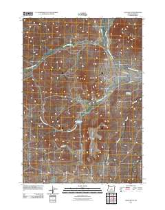
2011 Map of Logan Butte
USGS Topo · Published 2011About this map
Barnes Cemetery stands as a quiet marker of early settlement in this corner of Crook County, positioned near the intersection of several high-desert watercourses. The landscape is defined by its drainages, including West Fork Camp Creek, Middle Fork Camp Creek, and Pole Creek, which illustrate the complex watershed management necessary in this arid environment. Strategic water storage is evident through named features like Logan Butte Reservoir, Ammons Reservoir, and Bench Reservoir, supporting the ranching and agricultural operations that characterize the region. Distinctive geological formations such as Logan Butte and Smoky Butte serve as primary landmarks for navigation across the basin. The road network, featuring Tackman Rd and SE Camp Creek Rd, follows the natural contours of the creeks, connecting remote homesteads and grazing lands in a pattern that has persisted for generations.
Find a feature on this map
14 named features on this map. Tap any name to fly to it.
Don’t see what you’re looking for? This feature index may not catch every label — zoom into the map to look around manually.
Map Details
Editions of this 2011 Logan Butte Map
This is the sole edition of this map. No revisions or reprints were ever made.
Other maps of this area

1951 · Post
USGS Topo · 1:62,500

1955 · Crescent
USGS Topo · 1:250,000

1955 · Bend
USGS Topo · 1:250,000

1957 · Crescent
USGS Topo · 1:250,000

1957 · Bend
USGS Topo · 1:250,000

1958 · Crescent
USGS Topo · 1:250,000

1958 · Bend
USGS Topo · 1:250,000

1970 · Crescent
USGS Topo · 1:250,000

1981 · Prineville
USGS Topo · 1:100,000

1982 · Arrowwood Point
USGS Topo · 1:24,000