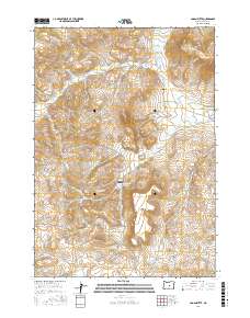
2017 Map of Logan Butte
USGS Topo · Published 2017About this map
Logan Butte and Smoky Butte dominate this section of the high desert in Crook County, where the landscape is defined by the ephemeral drainages and vital water management infrastructure of central Oregon. The presence of Barnes Cem near the junction of SE Camp Creek Rd and W Fork Camp Cr provides a point of genealogical interest in an area otherwise characterized by livestock grazing and vast open range. The drainage systems of Parrish Cr, Indian Cr, and the Middle Fork Camp Cr feed several essential holding sites, including Ammons Reservoir, Bench Reservoir, and the Logan Butte Reservoir. This network of roads, including Van Lake Rd and Camp Creek Rd, traces the ancient paths between these water sources and the surrounding ridges like Yank Gulch.
Find a feature on this map
20 named features on this map. Tap any name to fly to it.
Don’t see what you’re looking for? This feature index may not catch every label — zoom into the map to look around manually.
Map Details
Editions of this 2017 Logan Butte Map
This is the sole edition of this map. No revisions or reprints were ever made.
Other maps of this area

1951 · Post
USGS Topo · 1:62,500

1955 · Crescent
USGS Topo · 1:250,000

1955 · Bend
USGS Topo · 1:250,000

1957 · Crescent
USGS Topo · 1:250,000

1957 · Bend
USGS Topo · 1:250,000

1958 · Crescent
USGS Topo · 1:250,000

1958 · Bend
USGS Topo · 1:250,000

1970 · Crescent
USGS Topo · 1:250,000

1981 · Prineville
USGS Topo · 1:100,000

1982 · Arrowwood Point
USGS Topo · 1:24,000