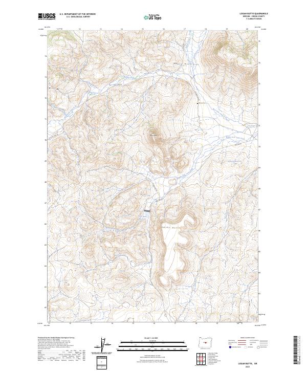
2023 Map of Logan Butte
USGS Topo · Published 2023About this map
Maury Mountains terrain dominates this high-desert portion of Crook County, where the landscape is defined by volcanic features and a sophisticated network of seasonal water management. Rising above the draws, Logan Butte and Smoky Butte serve as prominent landmarks in a territory largely dedicated to ranching and watershed control. The presence of Ammons Reservoir, Logan Butte Reservoir, and Bench Reservoir points to the vital role of water storage in this arid environment, capturing runoff from the many creek forks that dissect the uplands.
Find a feature on this map
21 named features on this map. Tap any name to fly to it.
Don’t see what you’re looking for? This feature index may not catch every label — zoom into the map to look around manually.
Map Details
Editions of this 2023 Logan Butte Map
This is the sole edition of this map. No revisions or reprints were ever made.
Other maps of this area

1951 · Post
USGS Topo · 1:62,500

1955 · Crescent
USGS Topo · 1:250,000

1955 · Bend
USGS Topo · 1:250,000

1957 · Crescent
USGS Topo · 1:250,000

1957 · Bend
USGS Topo · 1:250,000

1958 · Crescent
USGS Topo · 1:250,000

1958 · Bend
USGS Topo · 1:250,000

1970 · Crescent
USGS Topo · 1:250,000

1981 · Prineville
USGS Topo · 1:100,000

1982 · Arrowwood Point
USGS Topo · 1:24,000