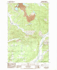
1984 Map of Logan Hill
USGS Topo · Published 1985About this map
Mendota and Kopiah appear as historical sites in this mid-1980s landscape, marking the transition from early resource extraction to modern land management. Large-scale industrial activity is evidenced by a significant Open Pit Mine in the north, while local agriculture and community life center on Logan Hill and the Logan Hill Grange. The complex drainage network is dominated by the Newaukum River and the Fork North Newaukum River, which collect numerous tributaries like Hanaford Creek and Lucas Creek. The map documents a period of industrial infrastructure, including a Meter Station and Cooling Towers, alongside a rural road system featuring Nulls Crossing and Hanaford Road. This survey provides a look at the intersection of heavy industry and rural residential patterns on the outskirts of Lewis County's larger settlements.
Find a feature on this map
35 named features on this map. Tap any name to fly to it.
Don’t see what you’re looking for? This feature index may not catch every label — zoom into the map to look around manually.
Map Details
Editions of this 1984 Logan Hill Map
This is the sole edition of this map. No revisions or reprints were ever made.
Other maps of this area

1916 · Chehalis
USGS Topo · 1:125,000

1940 · Tenino
USGS Topo · 1:62,500

1943 · Willapa
USGS Topo · 1:62,500

1944 · Tenino
USGS Topo · 1:62,500

1944 · Yelm
USGS Topo · 1:62,500

1949 · Yelm
USGS Topo · 1:62,500

1949 · Tenino
USGS Topo · 1:62,500

1953 · Hoquiam
USGS Topo · 1:250,000

1954 · Onalaska
USGS Topo · 1:62,500

1954 · Centralia
USGS Topo · 1:62,500