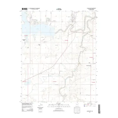
2013 Map of Logan South
USGS Topo · Published 2013About this map
Ute Reservoir and the winding course of the Canadian River define the high plains geography of this Quay County region. The map shows the southern expansion of Logan as it transitions from a traditional river town to a recreational and ranching hub. Residential street grids like Bluegill Rd and S Shore Dr demonstrate development along the reservoir's banks, while the surrounding land remains anchored by established family holdings and water sources.
Find a feature on this map
47 named features on this map. Tap any name to fly to it.
Don’t see what you’re looking for? This feature index may not catch every label — zoom into the map to look around manually.
Map Details
Editions of this 2013 Logan South Map
This is the sole edition of this map. No revisions or reprints were ever made.
Other maps of this area

1930 · Tucumcari
USGS Topo · 1:125,000

1954 · Tucumcari
USGS Topo · 1:250,000

1958 · Tucumcari
USGS Topo · 1:250,000

1962 · Logan
USGS Topo · 1:62,500

1968 · Porter
USGS Topo · 1:24,000

1968 · Hudson
USGS Topo · 1:24,000

1968 · San Jon NW
USGS Topo · 1:24,000

1968 · Lesbia
USGS Topo · 1:24,000

1968 · Montesito Creek
USGS Topo · 1:24,000
1989 · Tuscocoillo Canyon
USGS Topo · 1:24,000