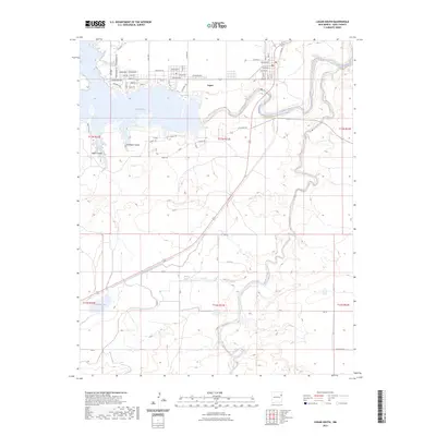
2023 Map of Logan South
USGS Topo · Published 2023About this map
Ute Reservoir and the Canadian River dominate this modern topographic view of the High Plains landscape in Quay County. The settlement of Logan sits along the northern shore, where a network of residential streets with names like Walleyed Dr and Catfish reflects the area's development around the reservoir's recreation economy. South of the water, the terrain breaks into more complex drainage patterns including Antelope Canyon and Mine Canyon.
Find a feature on this map
65 named features on this map. Tap any name to fly to it.
Don’t see what you’re looking for? This feature index may not catch every label — zoom into the map to look around manually.
Map Details
Editions of this 2023 Logan South Map
This is the sole edition of this map. No revisions or reprints were ever made.
Other maps of this area

1930 · Tucumcari
USGS Topo · 1:125,000

1954 · Tucumcari
USGS Topo · 1:250,000

1958 · Tucumcari
USGS Topo · 1:250,000

1962 · Logan
USGS Topo · 1:62,500

1968 · Porter
USGS Topo · 1:24,000

1968 · Hudson
USGS Topo · 1:24,000

1968 · San Jon NW
USGS Topo · 1:24,000

1968 · Lesbia
USGS Topo · 1:24,000

1968 · Montesito Creek
USGS Topo · 1:24,000
1989 · Tuscocoillo Canyon
USGS Topo · 1:24,000