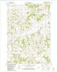
1983 Map of Loganville
USGS Topo · Published 1983About this map
Loganville and Hill Point anchor this landscape where the undulating terrain of Sauk County meets a dense network of country roads and family-named landmarks. The map reveals a deeply established rural community, evidenced by numerous ecclesiastical sites including Tuckertown Cem, St Peter Cem, and St Pauls Cem. These points of interest are scattered across the townships of Ironton, Washington, and Westfield, reflecting the early administrative divisions of the region.
Find a feature on this map
56 named features on this map. Tap any name to fly to it.
Don’t see what you’re looking for? This feature index may not catch every label — zoom into the map to look around manually.
Map Details
Editions of this 1983 Loganville Map
This is the sole edition of this map. No revisions or reprints were ever made.
Other maps of this area

1901 · Denzer
USGS Topo · 1:62,500

1901 · The Dells
USGS Topo · 1:62,500

1905 · Richland Center
USGS Topo · 1:125,000

1956 · Reedsburg
USGS Topo · 1:62,500

1957 · Wisconsin Dells
USGS Topo · 1:62,500

1957 · Madison
USGS Topo · 1:250,000

1958 · North Freedom
USGS Topo · 1:62,500

1958 · La Crosse
USGS Topo · 1:250,000

1960 · Madison
USGS Topo · 1:250,000

1960 · Plain
USGS Topo · 1:62,500