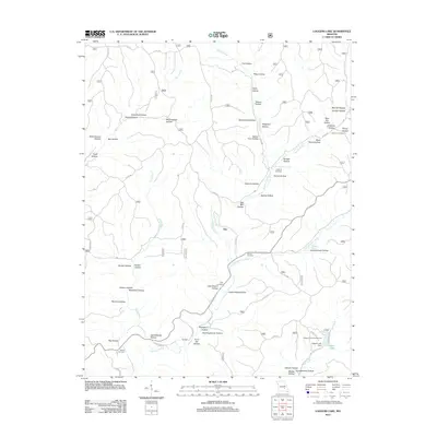
2012 Map of Loggers Lake
USGS Topo · Published 2012About this map
Gila and the smaller settlement of Hardage anchor this section of the Ozark landscape, where the terrain is defined by an intricate network of hollows and springs. The map reveals a high concentration of small family and community burial grounds, such as Hanning Cemetery, Swiney Cemetery, and Chatman Cemetery, which provide invaluable touchstones for genealogical research in this rural corridor. In the southeastern corner, Loggers Lake and the Loggers Lake Dam mark a transition from the narrow drainages of Sinking Creek and Barren Fork to a managed water resource and recreational area at the Loggers Lake Campground. The presence of numerous named springs, including Highley Spring and Sugar Tree Grove Spring, underscores the importance of groundwater in shaping the local economy and settlement patterns throughout the numerous valleys like Hellums Hollow and Parks Hollow.
Find a feature on this map
68 named features on this map. Tap any name to fly to it.
Don’t see what you’re looking for? This feature index may not catch every label — zoom into the map to look around manually.
Map Details
Editions of this 2012 Loggers Lake Map
This is the sole edition of this map. No revisions or reprints were ever made.
Other maps of this area

1941 · Stone Hill
USGS Topo · 1:62,500

1943 · Boss
USGS Topo · 1:62,500

1944 · Corridon
USGS Topo · 1:62,500

1945 · Stone Hill
USGS Topo · 1:62,500

1945 · Round Spring
USGS Topo · 1:62,500

1946 · Boss
USGS Topo · 1:62,500

1947 · Sinkin
USGS Topo · 1:48,000

1947 · Corridon
USGS Topo · 1:62,500

1949 · Round Spring
USGS Topo · 1:62,500

1949 · Rolla
USGS Topo · 1:250,000