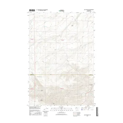
2017 Map of Logy Creek SW
USGS Topo · Published 2017About this map
The Simcoe Mountains define the southern landscape of this 2017 survey, dominated by the prominent peak of Simcoe Butte. This area on the border of Yakima and Klickitat counties is characterized by a complex network of drainage systems and deep cuts, most notably Black Canyon and Wilson Charley Canyon. The map records an intricate web of Bureau of Indian Affairs routes, such as Bia RD 284 and Bia RD 79, which provide access to these remote reaches. Significant watercourses including Logy Cr and Satus Cr carve through the terrain, with numerous forks like N Fork Kusshi Cr and S Fork Yatama Cr feeding the primary basins. The presence of Telephone Canyon and the named Wilson Charley Canyon Rd indicates specific historical corridors through this high-relief geography.
Find a feature on this map
32 named features on this map. Tap any name to fly to it.
Don’t see what you’re looking for? This feature index may not catch every label — zoom into the map to look around manually.
Map Details
Editions of this 2017 Logy Creek SW Map
This is the sole edition of this map. No revisions or reprints were ever made.
Other maps of this area

1937 · White Swan
USGS Topo · 1:125,000

1950 · Yakima
USGS Topo · 1:250,000

1953 · The Dalles
USGS Topo · 1:250,000

1956 · The Dalles
USGS Topo · 1:250,000

1957 · The Dalles
USGS Topo · 1:250,000

1957 · Goldendale
USGS Topo · 1:62,500

1957 · Satus Pass
USGS Topo · 1:62,500

1958 · Yakima
USGS Topo · 1:250,000

1961 · Yakima
USGS Topo · 1:250,000
1965 · Kusshi Creek
USGS Topo · 1:24,000