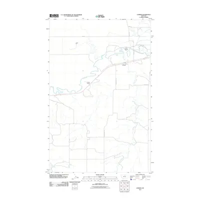
2011 Map of Lohman
USGS Topo · Published 2011About this map
The Milk River meanders through this portion of Blaine County, Montana, defining a landscape shaped by water management and rural ranching routes. Near the settlement of Lohman, the river is punctuated by the Fort Belknap Dam, a critical piece of local infrastructure. Further north, the L Krott Dam manages smaller water flows in an area where the terrain begins to rise toward features like Davey Coulee. The map reveals a network of descriptively named local roads that reflect the character of the northern plains, including Drunk Rd, Lowesome Rd, and Plainsman Trail Rd. These routes connect isolated holdings to the primary corridor of Old Hwy 2, while tributaries such as Clear Creek and Little Boxelder Creek carve drainage patterns across the surrounding flats.
Find a feature on this map
16 named features on this map. Tap any name to fly to it.
Don’t see what you’re looking for? This feature index may not catch every label — zoom into the map to look around manually.
Map Details
Editions of this 2011 Lohman Map
This is the sole edition of this map. No revisions or reprints were ever made.
Other maps of this area

1904 · Yantic
USGS Topo · 1:62,500

1904 · Havre
USGS Topo · 1:62,500

1912 · Zurich
USGS Topo · 1:125,000

1912 · Thibedeau Lake
USGS Topo · 1:125,000

1953 · Havre
USGS Topo · 1:250,000

1956 · Lloyd
USGS Topo · 1:62,500

1957 · Havre
USGS Topo · 1:250,000

1958 · Havre
USGS Topo · 1:250,000

1959 · Shambo
USGS Topo · 1:62,500

1964 · Telescope Coulee
USGS Topo · 1:24,000