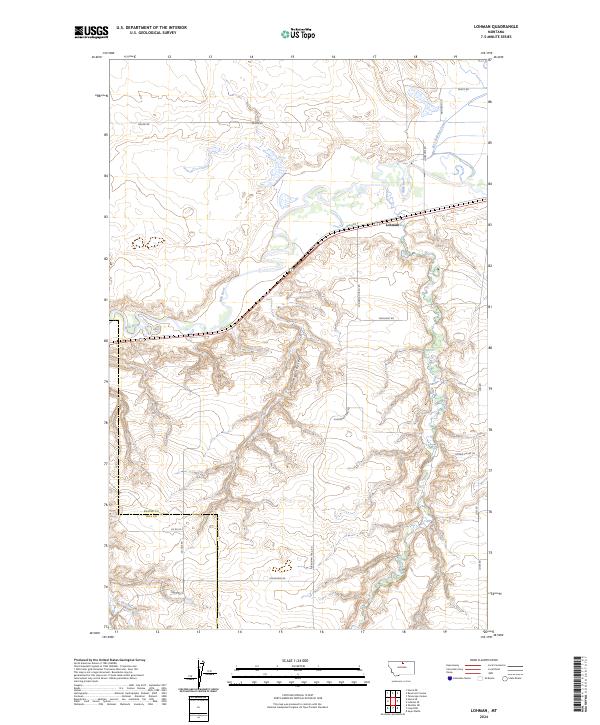
2024 Map of Lohman
USGS Topo · Published 2024About this map
The Lohman settlement anchors this modern topographical study, situated at the confluence of transport and irrigation systems along the Milk River. The Bnsf Railway runs parallel to Old Hwy 2, tracing the river valley's natural corridor through northern Montana. This landscape is defined by its water management, featuring the Fort Belknap Canal and natural drainages like Clear Creek and Little Boxelder. To the south, the terrain becomes increasingly dissected by deep erosional features such as Davey Coulee and Telescope Coulee. The boundary between Blaine County and Hill County bisects the southern sections of the map, illustrating how historical political lines often cut across the drainage basins. Rural life is evidenced by a network of local roads including Machinist Rd and Plains Man Trail Rd, which connect the highland pastures to the rail-side infrastructure at Lohman.
Find a feature on this map
26 named features on this map. Tap any name to fly to it.
Don’t see what you’re looking for? This feature index may not catch every label — zoom into the map to look around manually.
Map Details
Editions of this 2024 Lohman Map
This is the sole edition of this map. No revisions or reprints were ever made.
Other maps of this area

1904 · Yantic
USGS Topo · 1:62,500

1904 · Havre
USGS Topo · 1:62,500

1912 · Zurich
USGS Topo · 1:125,000

1912 · Thibedeau Lake
USGS Topo · 1:125,000

1953 · Havre
USGS Topo · 1:250,000

1956 · Lloyd
USGS Topo · 1:62,500

1957 · Havre
USGS Topo · 1:250,000

1958 · Havre
USGS Topo · 1:250,000

1959 · Shambo
USGS Topo · 1:62,500

1964 · Telescope Coulee
USGS Topo · 1:24,000