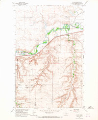
1964 Map of Lohman
USGS Topo · Published 1967About this map
The Milk River meanders through this portion of north-central Montana, defining a landscape of irrigated agriculture and mid-century industrial activity. The Great Northern railroad tracks parallel the river's northern banks, serving the settlement of Lohman, while the Canal and Fort Belknap Dam highlight the engineering efforts to manage water in this semi-arid region.
Find a feature on this map
21 named features on this map. Tap any name to fly to it.
Don’t see what you’re looking for? This feature index may not catch every label — zoom into the map to look around manually.
Map Details
Editions of this 1964 Lohman Map
This is the sole edition of this map. No revisions or reprints were ever made.
Other maps of this area

1904 · Yantic
USGS Topo · 1:62,500

1904 · Havre
USGS Topo · 1:62,500

1912 · Zurich
USGS Topo · 1:125,000

1912 · Thibedeau Lake
USGS Topo · 1:125,000

1953 · Havre
USGS Topo · 1:250,000

1956 · Lloyd
USGS Topo · 1:62,500

1957 · Havre
USGS Topo · 1:250,000

1958 · Havre
USGS Topo · 1:250,000

1959 · Shambo
USGS Topo · 1:62,500

1964 · Telescope Coulee
USGS Topo · 1:24,000