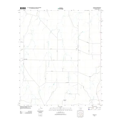
2013 Map of Lohn
USGS Topo · Published 2013About this map
Lohn and Pear Valley anchor this agricultural landscape in McCulloch County, where the terrain is defined by the branching tributaries of the Colorado River basin. The hydrology of the region is prominently displayed through the drainage patterns of Big Elm Cr, including its W Fork Big Elm Cr and E Fork Big Elm Cr, alongside Saddle Cr and Little Elm Cr. These watercourses carve through the Texas plains, leading toward significant topographical markers like Cottonwood Canyon and Cow Gap at the southern edge of the quadrangle. For those studying local heritage, the Lohn Cem serves as a central genealogical landmark. The network of county roads and ranch-to-market routes, such as Ranch Road 2635 and FM-504, illustrates the rural infrastructure connecting these isolated farming communities. A notable inclusion is the local naming of Old Broadmore, reflecting established transit paths in this part of West Central Texas.
Find a feature on this map
24 named features on this map. Tap any name to fly to it.
Don’t see what you’re looking for? This feature index may not catch every label — zoom into the map to look around manually.
Map Details
Editions of this 2013 Lohn Map
This is the sole edition of this map. No revisions or reprints were ever made.
Other maps of this area

1892 · Eden
USGS Topo · 1:125,000

1894 · Brady
USGS Topo · 1:125,000

1896 · Eden
USGS Topo · 1:125,000

1924 · Eden 1-a
USGS Topo · 1:48,000

1924 · Brady 2-a
USGS Topo · 1:48,000

1925 · Brady 2-b
USGS Topo · 1:48,000

1928 · Waldrip
USGS Topo · 1:62,500

1931 · Stacy
USGS Topo · 1:62,500

1954 · Brownwood
USGS Topo · 1:250,000

1960 · West Sweden
USGS Topo · 1:24,000