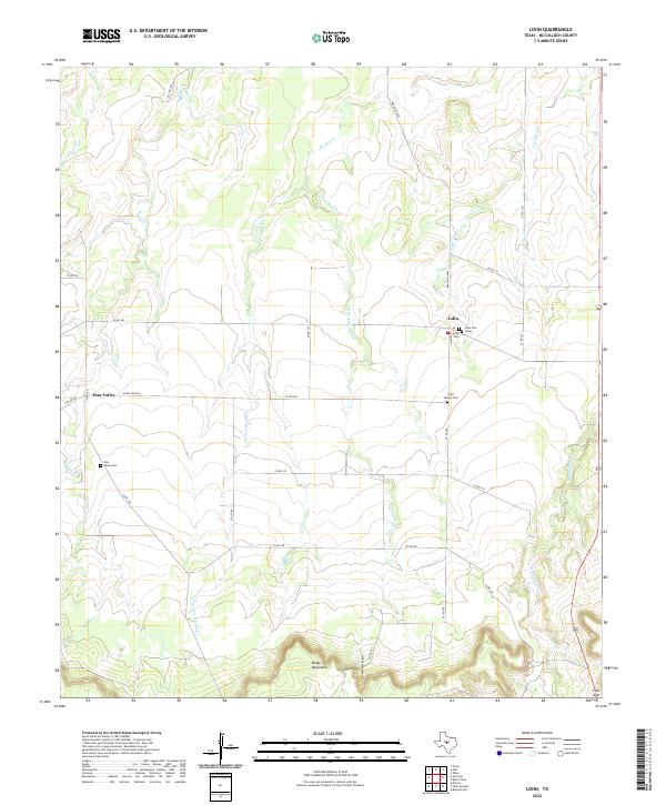
2022 Map of Lohn
USGS Topo · Published 2022About this map
The Brady Mountains rise sharply along the southern edge of this West Texas landscape, giving way to the complex drainage systems of the San Saba River watershed. The settlement of Lohn serves as a local hub, surrounded by significant genealogical markers including the Lohn Cem, Lohn Cem Annex, and the Lohn Family Cem. To the west, the community of Pear Valley is situated near the headwaters of Saddle Cr, with its own Pear Valley Cem serving the local population. The area's geography is defined by the branching tributaries of Big Elm Cr, including its East and West forks, which carve through the plains north of the mountains. Near the southeastern corner, Cottonwood Canyon cuts into the high ground near the passage known as Cow Gap, a distinctive terrain feature that has long influenced movement through this section of McCulloch County.
Find a feature on this map
32 named features on this map. Tap any name to fly to it.
Don’t see what you’re looking for? This feature index may not catch every label — zoom into the map to look around manually.
Map Details
Editions of this 2022 Lohn Map
This is the sole edition of this map. No revisions or reprints were ever made.
Other maps of this area

1892 · Eden
USGS Topo · 1:125,000

1894 · Brady
USGS Topo · 1:125,000

1896 · Eden
USGS Topo · 1:125,000

1924 · Eden 1-a
USGS Topo · 1:48,000

1924 · Brady 2-a
USGS Topo · 1:48,000

1925 · Brady 2-b
USGS Topo · 1:48,000

1928 · Waldrip
USGS Topo · 1:62,500

1931 · Stacy
USGS Topo · 1:62,500

1954 · Brownwood
USGS Topo · 1:250,000

1960 · West Sweden
USGS Topo · 1:24,000