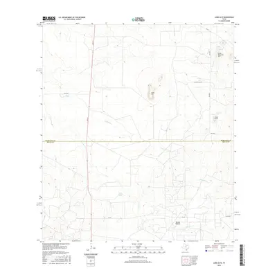
2016 Map of Loma Alta
USGS Topo · Published 2016About this map
Seven Sisters anchors the southern portion of this South Texas landscape, situated near the boundary between McMullen and Duval Counties. This 2016 survey illustrates a terrain defined by subtle elevation changes and seasonal drainage patterns, where features like Loma Alta and the Devils Waterhole Hills rise above the surrounding brush country. Water sources, vital for ranching and wildlife in this semi-arid environment, are marked by Charco Valiente Spring and Walker Lake, along with the courses of Drummond Cr and San Jose Cr. The infrastructure of the area consists largely of rural routes and ranch access, including Atkinson Ranch Rd and River St, reflecting the persistent land-use patterns of these South Texas borderlands.
Find a feature on this map
17 named features on this map. Tap any name to fly to it.
Don’t see what you’re looking for? This feature index may not catch every label — zoom into the map to look around manually.
Map Details
Editions of this 2016 Loma Alta Map
This is the sole edition of this map. No revisions or reprints were ever made.
Other maps of this area

1920 · Mikeska
USGS Topo · 1:125,000

1937 · Loma Alta
USGS Topo · 1:62,500

1953 · Crystal City
USGS Topo · 1:250,000

1955 · Crystal City
USGS Topo · 1:250,000

1956 · Rosita Ranch
USGS Topo · 1:62,500

1956 · Freer
USGS Topo · 1:62,500

1956 · Laredo
USGS Topo · 1:250,000

1961 · Crystal City
USGS Topo · 1:250,000

1968 · Crystal City
USGS Topo · 1:250,000
1969 · Loma Alta NE
USGS Topo · 1:24,000