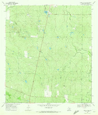
1969 Map of Loma Alta NE
USGS Topo · Published 1972About this map
Loma Alta serves as a small anchor in this rural South Texas landscape during the late 1960s. The terrain is defined by an extensive network of ephemeral drainages, including Leopard Creek and the curiously named Devils Waterhole Creek. Settlement patterns are distinctly tied to ranching, with the Hasete Ranch and Atkinson Ranch marking family-held lands across the brush country.
Find a feature on this map
15 named features on this map. Tap any name to fly to it.
Don’t see what you’re looking for? This feature index may not catch every label — zoom into the map to look around manually.
Map Details
Editions of this 1969 Loma Alta NE Map
2 editions found
Other maps of this area

1920 · Mikeska
USGS Topo · 1:125,000

1929 · Simmons
USGS Topo · 1:62,500

1930 · Tilden
USGS Topo · 1:62,500

1937 · Loma Alta
USGS Topo · 1:62,500

1942 · Tilden
USGS Topo · 1:62,500

1953 · Crystal City
USGS Topo · 1:250,000

1955 · Crystal City
USGS Topo · 1:250,000

1961 · Crystal City
USGS Topo · 1:250,000

1968 · Crystal City
USGS Topo · 1:250,000
1969 · San Caja Hill
USGS Topo · 1:24,000