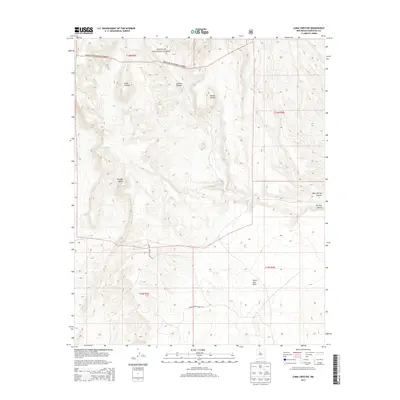
2013 Map of Loma Creston
USGS Topo · Published 2013About this map
Santa Fe National Forest encompasses the northern reaches of this Sandoval County landscape, where the terrain transitions from high mesas to deeply incised drainage systems. The topography is defined by significant landforms such as Loma Creston and Bodega Butte, which rise above the surrounding plains. To the south, the expansive Santa Ana Mesa dominates the horizon, separated from the forest by a network of seasonal watercourses and canyons. The drainage pattern is led by the Arroyo Arenoso, which carries runoff through the central valley, while Canovas Canyon and Borrego Canyon carve distinctive paths through the volcanic and sedimentary layers. Transportation through these indigenous lands is marked by the presence of Indian Service Route 787 and Indian Service Route 762, which provide essential access across the varied elevations of Mesita Cocida and toward Bear Springs Canyon.
Find a feature on this map
15 named features on this map. Tap any name to fly to it.
Don’t see what you’re looking for? This feature index may not catch every label — zoom into the map to look around manually.
Map Details
Editions of this 2013 Loma Creston Map
This is the sole edition of this map. No revisions or reprints were ever made.
Other maps of this area

1888 · Bernalillo
USGS Topo · 1:125,000

1889 · Albuquerque
USGS Topo · 1:125,000

1890 · Jemes
USGS Topo · 1:125,000

1892 · San Pedro
USGS Topo · 1:125,000

1892 · Jemes
USGS Topo · 1:125,000

1892 · Santa Clara
USGS Topo · 1:125,000

1893 · Albuquerque
USGS Topo · 1:125,000

1943 · Jemez
USGS Topo · 1:62,500

1952 · Jemez
USGS Topo · 1:62,500

1953 · Santo Domingo Pueblo SW
USGS Topo · 1:24,000