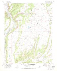
1968 Map of Loma Linda
USGS Topo · Published 1972About this map
The Southern Ute Indian Reservation Boundary cuts across this landscape southeast of Durango, where the Animas River and Florida River shape the local topography. This 1968 survey highlights the agricultural and industrial transformation of the mesas, evidenced by a dense network of irrigation infrastructure including the Denver and Rio Grande Western Ditch, Florida Canal, and Pioneer Ditch. These waterways support small communities like Loma Linda and Grandview while feeding the Pastorius Reservoir.
Find a feature on this map
52 named features on this map. Tap any name to fly to it.
Don’t see what you’re looking for? This feature index may not catch every label — zoom into the map to look around manually.
Map Details
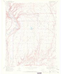
Editions of this 1968 Loma Linda Map
2 editions found
Other maps of this area

1898 · Durango
USGS Topo · 1:62,500

1907 · Durango
USGS Topo · 1:62,500

1908 · Ignacio
USGS Topo · 1:125,000

1908 · Durango
USGS Topo · 1:62,500

1924 · Ignacio
USGS Topo · 1:125,000

1945 · Durango
USGS Topo · 1:250,000

1953 · Durango
USGS Topo · 1:250,000

1954 · Durango
USGS Topo · 1:250,000

1961 · Durango
USGS Topo · 1:250,000

1963 · Durango
USGS Topo · 1:250,000