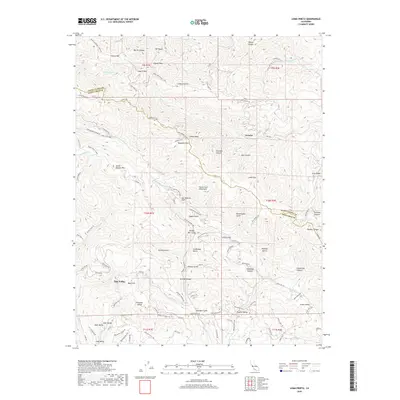
2018 Map of Loma Prieta
USGS Topo · Published 2018About this map
The San Andreas Fault cuts a diagonal path through this 2018 survey of the southern Santa Cruz Mountains, marking the tectonic boundary between the Santa Clara and Santa Cruz county lines. High ridges are defined by peaks like Loma Prieta and Mt Chual, while the drainage network of Uvas Cr and Soquel Cr carves deep canyons through the landscape. This era shows a complex mix of protected wilderness and established mountain communities, from the resort enclave at Sveadal to the residential clusters in Day Valley and Pleasant Valley.
Find a feature on this map
115 named features on this map. Tap any name to fly to it.
Don’t see what you’re looking for? This feature index may not catch every label — zoom into the map to look around manually.
Map Details
Editions of this 2018 Loma Prieta Map
This is the sole edition of this map. No revisions or reprints were ever made.
Other maps of this area

1912 · Capitola
USGS Topo · 1:62,500

1914 · Capitola
USGS Topo · 1:62,500

1915 · San Juan Bautista
USGS Topo · 1:48,000

1916 · New Almaden
USGS Topo · 1:48,000

1917 · Morgan Hill
USGS Topo · 1:62,500

1917 · San Juan Bautista
USGS Topo · 1:62,500

1919 · New Almaden
USGS Topo · 1:62,500

1939 · Morgan Hill
USGS Topo · 1:62,500

1939 · San Juan Bautista
USGS Topo · 1:62,500

1940 · San Juan Bautista
USGS Topo · 1:62,500