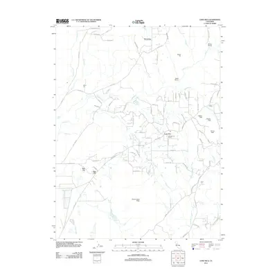
2012 Map of Loma Rica
USGS Topo · Published 2012About this map
Loma Rica and the surrounding foothill settlements of Olive Hill and Sunnyslope define this landscape during the early 21st century. The map illustrates a complex network of irrigation and water management essential to the region's agricultural history, featuring the Bangor Ditch, Mahle Ditch, and Olive Hill Ditch. These waterways weave through a terrain marked by prominent elevations such as Lafferty Peak, Johnson Peak, and Paynes Peak to the east, while Browns Valley Ridge anchors the southern portion of the sheet. For those researching local heritage, the map identifies the Fruitland Union School and provides precise locations for both the Honcut Cem and Peoria Cem. The drainage patterns of S Honcut Cr and Prairie Cr further characterize this portion of Yuba County, showing how historical land use follows the natural ravines and ridges.
Find a feature on this map
76 named features on this map. Tap any name to fly to it.
Don’t see what you’re looking for? This feature index may not catch every label — zoom into the map to look around manually.
Map Details
Editions of this 2012 Loma Rica Map
This is the sole edition of this map. No revisions or reprints were ever made.
Other maps of this area

1888 · Marysville
USGS Topo · 1:125,000

1888 · Smartsville
USGS Topo · 1:125,000

1891 · Marysville
USGS Topo · 1:125,000

1891 · Smartsville
USGS Topo · 1:125,000

1892 · Smartsville
USGS Topo · 1:125,000

1894 · Smartsville
USGS Topo · 1:125,000

1894 · Marysville
USGS Topo · 1:125,000

1895 · Marysville
USGS Topo · 1:125,000

1895 · Smartsville
USGS Topo · 1:125,000

1911 · Browns Valley
USGS Topo · 1:31,680