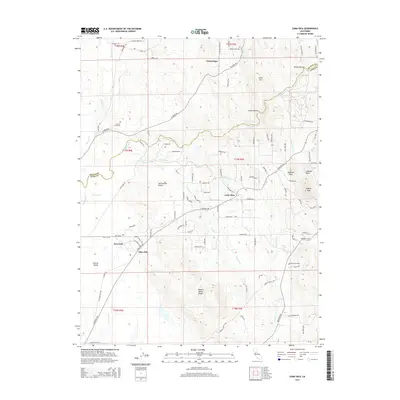
2015 Map of Loma Rica
USGS Topo · Published 2015About this map
Loma Rica and the surrounding foothills of the Sacramento Valley are documented here during a period of rural residential development and agricultural land use. The terrain transitions from the low Central Valley floor in the west toward the prominent elevations of Browns Valley Ridge, Lafferty Peak, and Johnson Peak in the east. Local history is anchored by several long-established community centers, including Olive Hill and Iowa City, alongside the Honcut Cemetery and Peoria Cemetery. The landscape is intricately defined by water management features such as Mahle Ditch and the Bangor Ditch, which redirect water through the undulating ravines of Swain Ravine and Nelson Ravine to support the region’s orchards and small-scale farms. This detailed mapping of local roads like La Porte Rd and Loma Rica Rd highlights the persistent settlement patterns of this corner of Yuba County.
Find a feature on this map
101 named features on this map. Tap any name to fly to it.
Don’t see what you’re looking for? This feature index may not catch every label — zoom into the map to look around manually.
Map Details
Editions of this 2015 Loma Rica Map
This is the sole edition of this map. No revisions or reprints were ever made.
Other maps of this area

1888 · Marysville
USGS Topo · 1:125,000

1888 · Smartsville
USGS Topo · 1:125,000

1891 · Marysville
USGS Topo · 1:125,000

1891 · Smartsville
USGS Topo · 1:125,000

1892 · Smartsville
USGS Topo · 1:125,000

1894 · Smartsville
USGS Topo · 1:125,000

1894 · Marysville
USGS Topo · 1:125,000

1895 · Marysville
USGS Topo · 1:125,000

1895 · Smartsville
USGS Topo · 1:125,000

1911 · Browns Valley
USGS Topo · 1:31,680