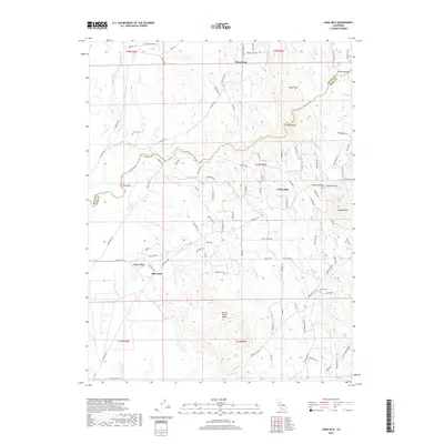
2018 Map of Loma Rica
USGS Topo · Published 2018About this map
Loma Rica and the surrounding foothill settlements of Iowa City and Olive Hill occupy a landscape defined by the complex water management systems of the northern Central Valley. The map documents an intricate network of hydraulic features, including Mahle Ditch and Bangor Ditch, which redirect water across the undulating terrain. To the north, the boundary between Butte Co and Yuba Co follows the course of N Honcut Cr and S Honcut Cr, highlighting the importance of these waterways as natural and political dividers. Genealogical interests are served by the inclusion of Honcut Cem and Peoria Cem, while prominent elevations like Swain Hill, Lafferty Peak, and Browns Valley Ridge provide clear landmarks for understanding the area's physical geography. The road network, including historic routes like La Porte Rd, reflects the area's connection to earlier mining and ranching corridors.
Find a feature on this map
100 named features on this map. Tap any name to fly to it.
Don’t see what you’re looking for? This feature index may not catch every label — zoom into the map to look around manually.
Map Details
Editions of this 2018 Loma Rica Map
This is the sole edition of this map. No revisions or reprints were ever made.
Other maps of this area

1888 · Marysville
USGS Topo · 1:125,000

1888 · Smartsville
USGS Topo · 1:125,000

1891 · Marysville
USGS Topo · 1:125,000

1891 · Smartsville
USGS Topo · 1:125,000

1892 · Smartsville
USGS Topo · 1:125,000

1894 · Smartsville
USGS Topo · 1:125,000

1894 · Marysville
USGS Topo · 1:125,000

1895 · Marysville
USGS Topo · 1:125,000

1895 · Smartsville
USGS Topo · 1:125,000

1911 · Browns Valley
USGS Topo · 1:31,680