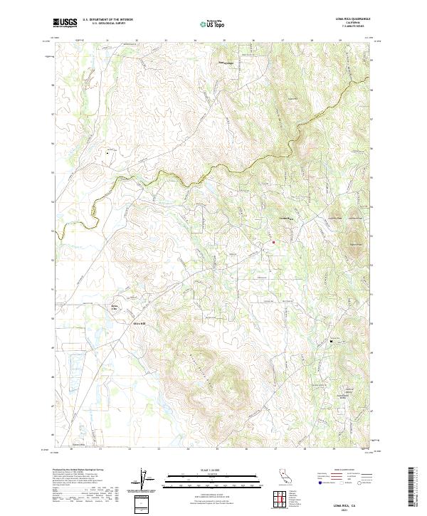
2021 Map of Loma Rica
USGS Topo · Published 2021About this map
Loma Rica and the surrounding foothill settlements of Sunnyslope, Iowa City, and Olive Hill sit at the edge of the Sacramento Valley in this detailed look at Yuba County's interior landscape. The map reveals an intricate network of water management, defined by the Mahle Ditch, Bangor Ditch, and Jack Slough, which highlight the region's reliance on irrigation for its agricultural and ranching economy. The terrain transitions from the low-lying Central Valley to the more prominent elevations of Browns Valley Ridge and a series of peaks including Lafferty Peak, Johnson Peak, and Paynes Peak. Genealogists and local historians can locate the Honcut Cem near the northern boundary and the Peoria Cem further south. The presence of numerous named ravines and small watercourses like Prairie Cr and Little Dry Cr illustrates the complex drainage systems feeding into the S Honcut Cr and N Honcut Cr, documenting the modern rural character of these long-established California communities.
Find a feature on this map
103 named features on this map. Tap any name to fly to it.
Don’t see what you’re looking for? This feature index may not catch every label — zoom into the map to look around manually.
Map Details
Editions of this 2021 Loma Rica Map
This is the sole edition of this map. No revisions or reprints were ever made.
Other maps of this area

1888 · Marysville
USGS Topo · 1:125,000

1888 · Smartsville
USGS Topo · 1:125,000

1891 · Marysville
USGS Topo · 1:125,000

1891 · Smartsville
USGS Topo · 1:125,000

1892 · Smartsville
USGS Topo · 1:125,000

1894 · Smartsville
USGS Topo · 1:125,000

1894 · Marysville
USGS Topo · 1:125,000

1895 · Marysville
USGS Topo · 1:125,000

1895 · Smartsville
USGS Topo · 1:125,000

1911 · Browns Valley
USGS Topo · 1:31,680