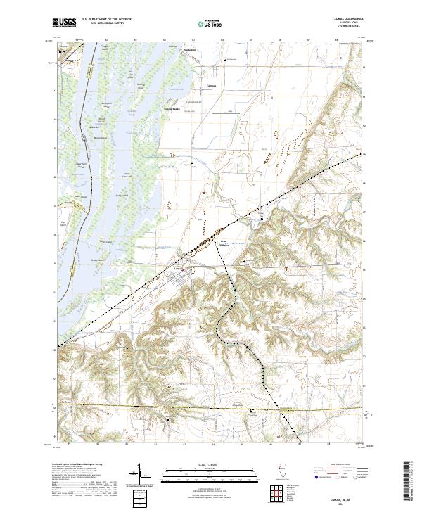
2024 Map of Lomax
USGS Topo · Published 2024About this map
Lomax stands as a focal point in this river-bottom landscape, where the town grid meets the edge of the dissected bluffs overlooking the Mississippi River. The region's geography is defined by a complex network of side channels and islands, including Burlington Island and Turkey Island, alongside significant water passages like Turkey Chute and Skunk Slough. This modern survey reveals a dense concentration of historical burial sites, such as Gittings Mound Cem and the Talbert Family Cem, which offer significant value for genealogical research in this border area between Illinois and Iowa. The transition from the low-lying Yellow Banks to the elevated Gittings Mound illustrates the topographical variety that has influenced settlement patterns and agriculture since the early days of Henderson County development.
Find a feature on this map
68 named features on this map. Tap any name to fly to it.
Don’t see what you’re looking for? This feature index may not catch every label — zoom into the map to look around manually.
Map Details
Editions of this 2024 Lomax Map
This is the sole edition of this map. No revisions or reprints were ever made.
Other maps of this area

1918 · La Harpe
USGS Topo · 1:62,500

1932 · Lomax
USGS Topo · 1:62,500

1934 · Oquawka
USGS Topo · 1:48,000

1934 · Burlington
USGS Topo · 1:48,000

1937 · Lomax
USGS Topo · 1:62,500

1940 · Oquawka
USGS Topo · 1:62,500

1940 · Burlington
USGS Topo · 1:62,500

1958 · Burlington
USGS Topo · 1:250,000

1961 · Burlington
USGS Topo · 1:250,000

1963 · Burlington
USGS Topo · 1:250,000