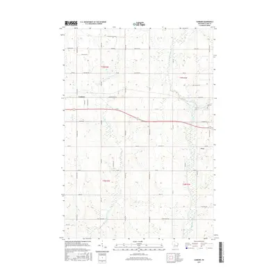
2015 Map of Lombard
USGS Topo · Published 2015About this map
The Black River and the S Fork Eau Claire River define the drainage and topography of this central Wisconsin landscape. Agricultural patterns are evident through a dense grid of rural corridors, including Colby Factory Rd and Pussywillow Lane BB, which partition the dairy country of Clark County. The community of Lombard sits near the western edge of the sheet, while the outskirts of Owen occupy the eastern boundary, providing a look at the transition from small village centers to the surrounding woodlots and fields. On the banks of the river, Riverside Cem serves as a significant landmark for genealogical research, anchoring the local history of the surrounding townships. The map also records specialized transit and infrastructure such as W Airport Rd, reflecting the modern development of this rural region.
Find a feature on this map
27 named features on this map. Tap any name to fly to it.
Don’t see what you’re looking for? This feature index may not catch every label — zoom into the map to look around manually.
Map Details
Editions of this 2015 Lombard Map
This is the sole edition of this map. No revisions or reprints were ever made.
Other maps of this area

1951 · Lublin
USGS Topo · 1:48,000

1951 · Gilman
USGS Topo · 1:62,500

1952 · Stanley
USGS Topo · 1:62,500

1953 · Owen
USGS Topo · 1:48,000

1953 · Eau Claire
USGS Topo · 1:250,000

1953 · Rice Lake
USGS Topo · 1:250,000

1958 · Eau Claire
USGS Topo · 1:250,000

1959 · Rice Lake
USGS Topo · 1:250,000

1963 · Owen
USGS Topo · 1:62,500

1964 · Eau Claire
USGS Topo · 1:250,000