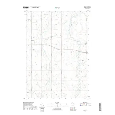
2018 Map of Lombard
USGS Topo · Published 2018About this map
The Black River and S Fork Eau Claire River drain this rural landscape of Clark County, which is defined by a rigorous grid of section lines and gravel roads. Located just west of Owen, the map captures a period of modern land use where agricultural heritage persists alongside small-scale local infrastructure. The settlement of Lombard serves as a central landmark in an area primarily organized by long country thoroughfares like Tamarack Rd C and Bachelors Ave. Genealogists may find particular interest in Riverside Cem near the eastern bend of the river, while the naming of routes such as Colby Factory Rd and French Town Ave points to the dairy industry and early ethnic settlement patterns that shaped the region. The map also documents the transition to recreational and utility access through names like W Airport Rd and Pussywillow Lane 88.
Find a feature on this map
35 named features on this map. Tap any name to fly to it.
Don’t see what you’re looking for? This feature index may not catch every label — zoom into the map to look around manually.
Map Details
Editions of this 2018 Lombard Map
This is the sole edition of this map. No revisions or reprints were ever made.
Other maps of this area

1951 · Lublin
USGS Topo · 1:48,000

1951 · Gilman
USGS Topo · 1:62,500

1952 · Stanley
USGS Topo · 1:62,500

1953 · Owen
USGS Topo · 1:48,000

1953 · Eau Claire
USGS Topo · 1:250,000

1953 · Rice Lake
USGS Topo · 1:250,000

1958 · Eau Claire
USGS Topo · 1:250,000

1959 · Rice Lake
USGS Topo · 1:250,000

1963 · Owen
USGS Topo · 1:62,500

1964 · Eau Claire
USGS Topo · 1:250,000