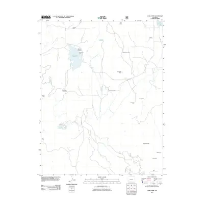
2011 Map of Lone Cone
USGS Topo · Published 2011About this map
Miramonte Reservoir and its associated dam dominate the northern terrain of this Dolores County landscape, serving as a focal point for water management and recreation. The area is defined by a network of high-altitude agricultural and livestock infrastructure, including the Last Chance Ditch, Cone Ditch, and Lilylands Canal, which draw from local sources like Middle Naturita Creek and Lilylands Reservoir.
Find a feature on this map
41 named features on this map. Tap any name to fly to it.
Don’t see what you’re looking for? This feature index may not catch every label — zoom into the map to look around manually.
Map Details
Editions of this 2011 Lone Cone Map
This is the sole edition of this map. No revisions or reprints were ever made.
Other maps of this area

1956 · Cortez
USGS Topo · 1:250,000

1956 · Moab
USGS Topo · 1:250,000

1958 · Cortez
USGS Topo · 1:250,000

1959 · Cortez
USGS Topo · 1:250,000

1959 · Moab
USGS Topo · 1:250,000

1960 · Moab
USGS Topo · 1:250,000

1962 · Moab
USGS Topo · 1:250,000

1962 · Cortez
USGS Topo · 1:250,000

1964 · Moab
USGS Topo · 1:250,000
1964 · Groundhog Reservoir
USGS Topo · 1:24,000