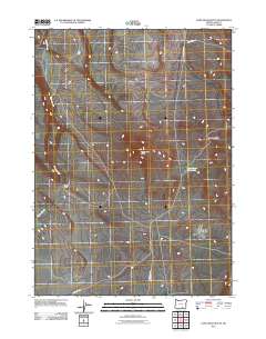
2011 Map of Lone Grave Butte
USGS Topo · Published 2011About this map
Lone Grave Butte stands as a prominent landmark in this high desert region of Lake County, overseeing a landscape defined by seasonal water sources and expansive basins. The topographic detail captures the floor of the Guano Valley, where the intermittent drainage of Guano Slough carves a path through the arid terrain. The map illustrates a network of remote routes, including Beatys Butte Rd and Lone Grave Rd, which served the ranching and resource needs of this isolated corner of Oregon. Crucial water points for livestock and travelers are documented, most notably the Lone Grave Waterhole near the base of the butte. High-elevation transit points such as Buckaroo Pass provide further evidence of how the geography dictated movement across the sagebrush and scrubland at the start of the 21st century.
Find a feature on this map
8 named features on this map. Tap any name to fly to it.
Don’t see what you’re looking for? This feature index may not catch every label — zoom into the map to look around manually.
Map Details
Editions of this 2011 Lone Grave Butte Map
This is the sole edition of this map. No revisions or reprints were ever made.
Other maps of this area

1955 · Adel
USGS Topo · 1:250,000

1957 · Adel
USGS Topo · 1:250,000

1958 · Adel
USGS Topo · 1:250,000

1962 · Adel
USGS Topo · 1:250,000

1967 · Alger Lake
USGS Topo · 1:24,000

1967 · Swede Knoll
USGS Topo · 1:24,000

1968 · Guano Lake
USGS Topo · 1:24,000

1971 · Beatys Butte
USGS Topo · 1:24,000

1971 · Mahogany Butte
USGS Topo · 1:24,000
1971 · Beatys Butte NW
USGS Topo · 1:24,000