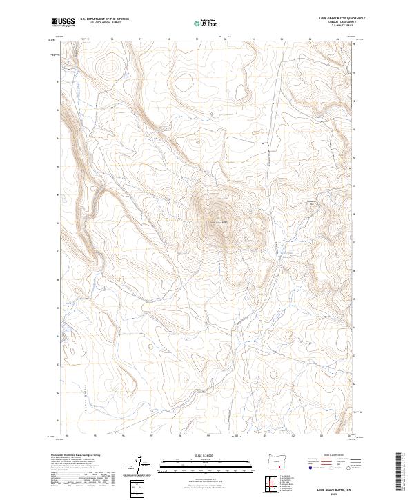
2023 Map of Lone Grave Butte
USGS Topo · Published 2023About this map
Lone Grave Butte dominates this high desert landscape within the southern reach of Lake County. This 2023 survey illustrates a geography defined by intermittent water features and volcanic relief, where the eastern edge of the Hart Mountain National Antelope Refuge meets the expanse of the Guano Valley. The drainage patterns of Guano Slough and Guano Canyon reveal the subtle hydrologic character of this arid environment, while the presence of the Lone Grave Waterhole suggests a historical reliance on specific, isolated water sources for livestock or wildlife.
Find a feature on this map
13 named features on this map. Tap any name to fly to it.
Don’t see what you’re looking for? This feature index may not catch every label — zoom into the map to look around manually.
Map Details
Editions of this 2023 Lone Grave Butte Map
This is the sole edition of this map. No revisions or reprints were ever made.
Other maps of this area

1955 · Adel
USGS Topo · 1:250,000

1957 · Adel
USGS Topo · 1:250,000

1958 · Adel
USGS Topo · 1:250,000

1962 · Adel
USGS Topo · 1:250,000

1967 · Alger Lake
USGS Topo · 1:24,000

1967 · Swede Knoll
USGS Topo · 1:24,000

1968 · Guano Lake
USGS Topo · 1:24,000

1971 · Beatys Butte
USGS Topo · 1:24,000

1971 · Mahogany Butte
USGS Topo · 1:24,000
1971 · Beatys Butte NW
USGS Topo · 1:24,000