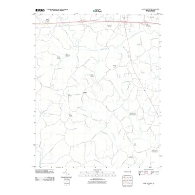
2010 Map of Lone Hickory
USGS Topo · Published 2010About this map
Lone Hickory and the surrounding rural landscape of Yadkin County are defined by a network of small creeks and community landmarks. This 2010 survey shows the area's agricultural character, where historical continuity is evident in the numerous family and community burial grounds, such as Brandons Friends Cemetery, Bethel Cemetery, and South Oak Ridge Cemetery. The drainage patterns of South Deep Creek and Fisher Creek are managed by a series of small impoundments, including the Thad Carlton Lake Dam and James Dobbins Lake Dam. The presence of the Felix Post Office and Clarksville Post Office points to established rural service centers, while Prison Unit Number 068 represents a more modern institutional development in the northeastern corner near the Yadkin Recreation Park Lake Dam.
Find a feature on this map
92 named features on this map. Tap any name to fly to it.
Don’t see what you’re looking for? This feature index may not catch every label — zoom into the map to look around manually.
Map Details
Editions of this 2010 Lone Hickory Map
This is the sole edition of this map. No revisions or reprints were ever made.
Other maps of this area

1891 · Yadkinville
USGS Topo · 1:125,000

1893 · Statesville
USGS Topo · 1:125,000

1893 · Yadkinville
USGS Topo · 1:125,000

1953 · Charlotte
USGS Topo · 1:250,000

1953 · Winston-Salem
USGS Topo · 1:250,000

1954 · Charlotte
USGS Topo · 1:250,000

1955 · Winston-Salem
USGS Topo · 1:250,000

1960 · Charlotte
USGS Topo · 1:250,000

1962 · Winston-Salem
USGS Topo · 1:250,000

1962 · Charlotte
USGS Topo · 1:250,000