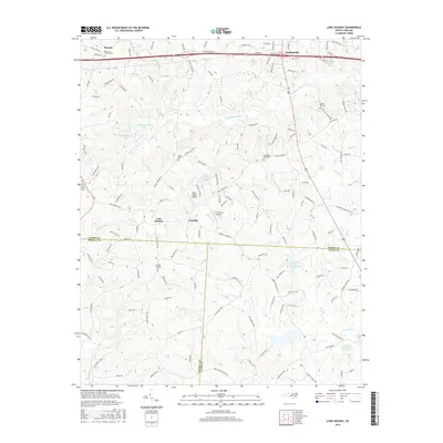
2016 Map of Lone Hickory
USGS Topo · Published 2016About this map
Yadkinville serves as the focal point in the northern reach of this North Carolina landscape, where the town's expansion meets the rural character of the southern foothills. The map reveals a complex border region where Yadkin, Iredell, and Davie counties converge, marked by the winding courses of Dutchman Creek and South Deep Creek. This area is defined by its small-scale aviation and water management, featuring both the Piney Ridge Airport and Lone Hickory Airport, alongside several watershed management structures like Dutchman Creek W/S Number Two. Scattered rural settlements such as Footville and Lone Hickory remain anchored by long-standing community landmarks, including Sandy Springs Cemetery and Bethel Church. The terrain is characterized by modest rises like Brandon Hills and the drainage patterns of Hunting Creek and Big Kennedy Creek, illustrating the transition from agricultural land to residential development near the Old US Hwy 421 corridor.
Find a feature on this map
145 named features on this map. Tap any name to fly to it.
Don’t see what you’re looking for? This feature index may not catch every label — zoom into the map to look around manually.
Map Details
Editions of this 2016 Lone Hickory Map
This is the sole edition of this map. No revisions or reprints were ever made.
Other maps of this area

1891 · Yadkinville
USGS Topo · 1:125,000

1893 · Statesville
USGS Topo · 1:125,000

1893 · Yadkinville
USGS Topo · 1:125,000

1953 · Charlotte
USGS Topo · 1:250,000

1953 · Winston-Salem
USGS Topo · 1:250,000

1954 · Charlotte
USGS Topo · 1:250,000

1955 · Winston-Salem
USGS Topo · 1:250,000

1960 · Charlotte
USGS Topo · 1:250,000

1962 · Winston-Salem
USGS Topo · 1:250,000

1962 · Charlotte
USGS Topo · 1:250,000