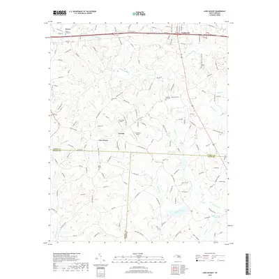
2019 Map of Lone Hickory
USGS Topo · Published 2019About this map
Yadkinville sits at the northern edge of this Piedmont landscape, where the town's expansion meets the rural drainages of South Deep Creek. The map documents a transition between the developing corridor of Old US Hwy 421 and the more traditional agricultural and wooded terrain to the south. Numerous small family and congregational burial grounds, such as Brandons Friends Cem, South Oak Ridge Cem, and Sandy Springs Cem, are scattered across the rolling hills, providing critical location data for genealogists tracing regional lineages.
Find a feature on this map
140 named features on this map. Tap any name to fly to it.
Don’t see what you’re looking for? This feature index may not catch every label — zoom into the map to look around manually.
Map Details
Editions of this 2019 Lone Hickory Map
This is the sole edition of this map. No revisions or reprints were ever made.
Other maps of this area

1891 · Yadkinville
USGS Topo · 1:125,000

1893 · Statesville
USGS Topo · 1:125,000

1893 · Yadkinville
USGS Topo · 1:125,000

1953 · Charlotte
USGS Topo · 1:250,000

1953 · Winston-Salem
USGS Topo · 1:250,000

1954 · Charlotte
USGS Topo · 1:250,000

1955 · Winston-Salem
USGS Topo · 1:250,000

1960 · Charlotte
USGS Topo · 1:250,000

1962 · Winston-Salem
USGS Topo · 1:250,000

1962 · Charlotte
USGS Topo · 1:250,000