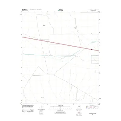
2011 Map of Lone Mountain
USGS Topo · Published 2011About this map
Lone Mountain stands as a prominent landmark in this desert landscape of La Paz County, situated between the expansive Adobe Flats to the east and the northern reaches of the Eagletail Mountains to the south. The area's character is defined by critical infrastructure supporting the arid environment, most notably the Central Arizona Project Aqueduct which traverses the center of the sheet. Vital water sources for the region are documented by isolated features like Lone Mountain Tank and Yuma Tank. The map reveals a network of utility and service corridors, including the El Paso Natural Gas Company Ac Rd and a grid of local routes such as Avenue 71 E and 54th St N, which facilitate movement through this sparsely populated terrain.
Find a feature on this map
11 named features on this map. Tap any name to fly to it.
Don’t see what you’re looking for? This feature index may not catch every label — zoom into the map to look around manually.
Map Details
Editions of this 2011 Lone Mountain Map
This is the sole edition of this map. No revisions or reprints were ever made.
Other maps of this area

1942 · Vicksburg
USGS Topo · 1:250,000

1954 · Phoenix
USGS Topo · 1:250,000

1957 · Phoenix
USGS Topo · 1:250,000

1958 · Phoenix
USGS Topo · 1:250,000

1960 · Phoenix
USGS Topo · 1:250,000

1961 · Hope
USGS Topo · 1:62,500

1961 · Lone Mountain
USGS Topo · 1:62,500

1962 · Little Horn Mts
USGS Topo · 1:62,500

1962 · Eagletail Mts
USGS Topo · 1:62,500

1969 · Phoenix
USGS Topo · 1:250,000