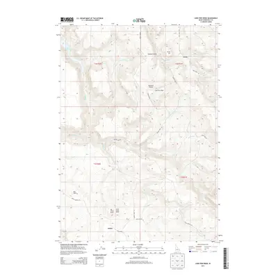
2013 Map of Lone Pine Ridge
USGS Topo · Published 2013About this map
Dehlin and the small settlement of Guyaz sit within this landscape defined by high ridges and complex drainage systems in eastern Idaho. The terrain is marked by prominent volcanic features like Red Butte, Big Horse Butte, and Little Horse Butte, which rise above the surrounding canyons and draws. A network of early thoroughfares, including the Harris Dugway and Kepps Crossing Rd, provides access across the ridgelines and through the many hollows. Water is a central feature of the topography, with Ririe Reservoir in the northwest and numerous seasonal and perennial streams such as Bulls Fork, Willow Cr, and Meadow Cr carving through the uplifted ground. The map details the transition from the high Lone Pine Ridge down into the narrow corridors of Dogtooth Hollow, illustrating the pastoral and ranching-oriented layout of Bonneville County in the early 21st century.
Find a feature on this map
28 named features on this map. Tap any name to fly to it.
Don’t see what you’re looking for? This feature index may not catch every label — zoom into the map to look around manually.
Map Details
Editions of this 2013 Lone Pine Ridge Map
This is the sole edition of this map. No revisions or reprints were ever made.
Other maps of this area

1924 · Hell Creek
USGS Topo · 1:62,500

1924 · Ammon
USGS Topo · 1:62,500

1926 · Hell Creek
USGS Topo · 1:62,500

1950 · Rigby
USGS Topo · 1:62,500

1950 · Rigby SE
USGS Topo · 1:24,000

1951 · Rigby SE
USGS Topo · 1:24,000

1951 · Poplar
USGS Topo · 1:24,000

1951 · Heise SE
USGS Topo · 1:24,000

1955 · Driggs
USGS Topo · 1:250,000

1958 · Driggs
USGS Topo · 1:250,000