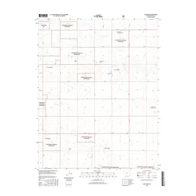
2016 Map of Lone Rock
USGS Topo · Published 2016About this map
Comanche National Grassland dominates this corner of Baca County, where the high plains are carved by a network of seasonal drainages. The landscape is defined by the ephemeral waters of Lone Rock Draw, North Fork Lone Rock Draw, and South Fork Lone Rock Draw, which converge near the namesake Lone Rock formation. This 2016 survey illustrates the grid-like infrastructure of the region, where gravel paths like Co RD W and Co RD BB provide the primary access to cattle ranges and isolated homesteads. For genealogists and local historians, the presence of the Prairie Queen Cem and Chapel Hill Cem offers vital physical links to the early dry-land farming families who settled this arid territory. The drainage of N Fork Sand Arroyo further emphasizes the importance of water management in this sparsely populated portion of southeastern Colorado.
Find a feature on this map
20 named features on this map. Tap any name to fly to it.
Don’t see what you’re looking for? This feature index may not catch every label — zoom into the map to look around manually.
Map Details
Editions of this 2016 Lone Rock Map
This is the sole edition of this map. No revisions or reprints were ever made.
Other maps of this area

1891 · Springfield
USGS Topo · 1:125,000

1892 · Mt Carrizo
USGS Topo · 1:125,000

1893 · Springfield
USGS Topo · 1:125,000

1955 · La Junta
USGS Topo · 1:250,000

1958 · La Junta
USGS Topo · 1:250,000

1968 · La Junta
USGS Topo · 1:250,000

1978 · Edler
USGS Topo · 1:24,000

1978 · Pritchett
USGS Topo · 1:24,000

1978 · Utleyville
USGS Topo · 1:24,000
1978 · Harbord
USGS Topo · 1:24,000