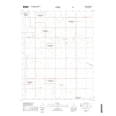
2019 Map of Lone Rock
USGS Topo · Published 2019About this map
Comanche National Grassland encompasses the majority of this high plains landscape in Baca County, characterized by a complex network of intermittent drainages and draws. The terrain is defined by wide, shallow valleys such as Lone Rock Draw and its tributaries, the North Fork and South Fork. These ephemeral watercourses reflect the arid climate and grazing history of the region. Scattered throughout this open country are local landmarks of historical and genealogical significance, including the Prairie Queen Cem and the Chapel Hill Cem, which serve as quiet markers of the homesteading families that once settled this corner of Colorado. The namesake Lone Rock stands as a distinctive topographic feature near the center of the survey, surrounded by a grid of rural county roads such as Co RD 10 and Co RD W that navigate the sections of the public land survey system.
Find a feature on this map
27 named features on this map. Tap any name to fly to it.
Don’t see what you’re looking for? This feature index may not catch every label — zoom into the map to look around manually.
Map Details
Editions of this 2019 Lone Rock Map
This is the sole edition of this map. No revisions or reprints were ever made.
Other maps of this area

1891 · Springfield
USGS Topo · 1:125,000

1892 · Mt Carrizo
USGS Topo · 1:125,000

1893 · Springfield
USGS Topo · 1:125,000

1955 · La Junta
USGS Topo · 1:250,000

1958 · La Junta
USGS Topo · 1:250,000

1968 · La Junta
USGS Topo · 1:250,000

1978 · Edler
USGS Topo · 1:24,000

1978 · Pritchett
USGS Topo · 1:24,000

1978 · Utleyville
USGS Topo · 1:24,000
1978 · Harbord
USGS Topo · 1:24,000