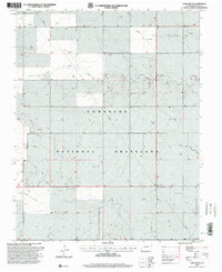
1996 Map of Lone Rock
USGS Topo · Published 2000About this map
Comanche National Grassland dominates the landscape of Baca County, where the high plains are carved by a complex network of seasonal drainages. This late-twentieth-century revision by the USDA Forest Service documents the intersection of agricultural heritage and industrial infrastructure in the High Plains. The map reveals quiet evidence of early settlement through isolated burial grounds such as Prairie Queen Cem and Chapel Hill Cem, located far from any concentrated township.
Find a feature on this map
13 named features on this map. Tap any name to fly to it.
Don’t see what you’re looking for? This feature index may not catch every label — zoom into the map to look around manually.
Map Details
Editions of this 1996 Lone Rock Map
This is the sole edition of this map. No revisions or reprints were ever made.
Other maps of this area

1891 · Springfield
USGS Topo · 1:125,000

1892 · Mt Carrizo
USGS Topo · 1:125,000

1893 · Springfield
USGS Topo · 1:125,000

1955 · La Junta
USGS Topo · 1:250,000

1958 · La Junta
USGS Topo · 1:250,000

1968 · La Junta
USGS Topo · 1:250,000

1978 · Edler
USGS Topo · 1:24,000

1978 · Pritchett
USGS Topo · 1:24,000

1978 · Utleyville
USGS Topo · 1:24,000
1978 · Harbord
USGS Topo · 1:24,000