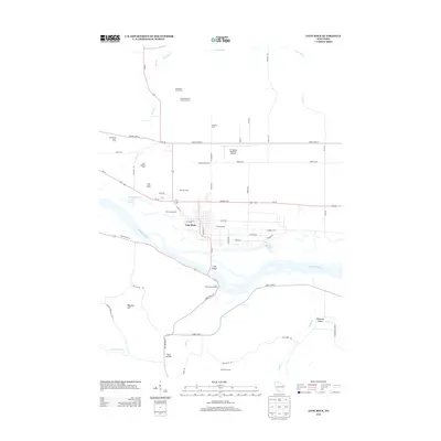
2013 Map of Lone Rock
USGS Topo · Published 2013About this map
Lone Rock serves as the central hub of this Wisconsin River landscape, situated just north of the water and west of the Tri-County Regional Airport. The area’s agricultural heritage is exceptionally well-documented through named properties such as the Mayflower Dairy Farm, Lone Rock Stock and Grain Farm, and Oak Grove Stock Farm. These labels provide a specific look at land use and family holdings north of the river, while Gilbertson Farms occupies the terrain to the south. The river itself is defined by complex water features including Cruson Slough, Bakkens Pond, and the significant Long Island, which splits the channel near the Lone Rock Boat Landing. To the south, the topography rises toward Bigelow Hill and the quiet reach of Penn Hollow, offering a detailed view of the driftless area's ridges and valleys at the start of the 21st century.
Find a feature on this map
59 named features on this map. Tap any name to fly to it.
Don’t see what you’re looking for? This feature index may not catch every label — zoom into the map to look around manually.
Map Details
Editions of this 2013 Lone Rock Map
This is the sole edition of this map. No revisions or reprints were ever made.
Other maps of this area

1905 · Richland Center
USGS Topo · 1:125,000

1958 · La Crosse
USGS Topo · 1:250,000

1960 · Richland Center
USGS Topo · 1:62,500

1960 · Plain
USGS Topo · 1:62,500

1960 · Muscoda
USGS Topo · 1:62,500

1960 · Spring Green
USGS Topo · 1:62,500

1961 · La Crosse
USGS Topo · 1:250,000

1965 · La Crosse
USGS Topo · 1:250,000

1976 · La Crosse
USGS Topo · 1:250,000
1983 · Pleasant Ridge
USGS Topo · 1:24,000