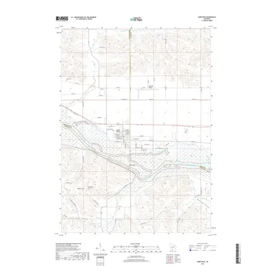
2018 Map of Lone Rock
USGS Topo · Published 2018About this map
Lone Rock sits at the northern edge of the Wisconsin River, serving as a central hub where the borders of Richland, Sauk, and Iowa counties converge. The village is characterized by a grid of local streets including W Liberty St and W Commercial St, situated just north of the expansive river bottoms. The landscape is defined by the braided channels and wetlands of the river valley, where Long Island and Bakkens Pond indicate a complex hydrological environment that has historically shaped local transit and land use.
Find a feature on this map
70 named features on this map. Tap any name to fly to it.
Don’t see what you’re looking for? This feature index may not catch every label — zoom into the map to look around manually.
Map Details
Editions of this 2018 Lone Rock Map
This is the sole edition of this map. No revisions or reprints were ever made.
Other maps of this area

1905 · Richland Center
USGS Topo · 1:125,000

1958 · La Crosse
USGS Topo · 1:250,000

1960 · Richland Center
USGS Topo · 1:62,500

1960 · Plain
USGS Topo · 1:62,500

1960 · Muscoda
USGS Topo · 1:62,500

1960 · Spring Green
USGS Topo · 1:62,500

1961 · La Crosse
USGS Topo · 1:250,000

1965 · La Crosse
USGS Topo · 1:250,000

1976 · La Crosse
USGS Topo · 1:250,000
1983 · Pleasant Ridge
USGS Topo · 1:24,000