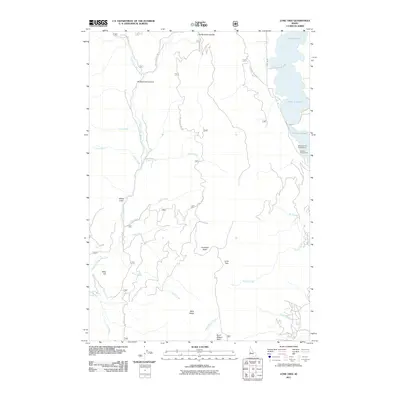
2011 Map of Lone Tree
USGS Topo · Published 2011About this map
Lake Cascade dominates the northeastern corner of this Valley County landscape, where the shoreline meets the slopes of West Mountain. The terrain is defined by a series of high ridges and basins that separate the drainage of the Middle Fork Weiser River from the Little Weiser River. This area is characterized by forest service access and recreational infrastructure, including the Rainbow Point Campground and Amanita Campground along the lake.
Find a feature on this map
31 named features on this map. Tap any name to fly to it.
Don’t see what you’re looking for? This feature index may not catch every label — zoom into the map to look around manually.
Map Details
Editions of this 2011 Lone Tree Map
This is the sole edition of this map. No revisions or reprints were ever made.
Other maps of this area

1911 · Meadows
USGS Topo · 1:125,000

1954 · Council
USGS Topo · 1:62,500

1954 · New Meadows
USGS Topo · 1:62,500

1954 · Cascade
USGS Topo · 1:62,500

1955 · Baker
USGS Topo · 1:250,000

1959 · Baker
USGS Topo · 1:250,000
1973 · No Business Mtn
USGS Topo · 1:24,000
1973 · Lake Fork
USGS Topo · 1:24,000

1980 · McCall
USGS Topo · 1:100,000
1985 · Cold Spring Ridge
USGS Topo · 1:24,000