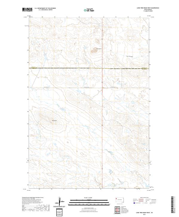
2021 Map of Lone Tree Draw West
USGS Topo · Published 2021About this map
The S Fork Moreau River winds through the southern reaches of this landscape, marking a significant drainage point for the surrounding high plains. Near the border of Harding and Butte counties, the terrain is defined by prominent topographical rises including Crow Buttes and Macy Butte, which provide clear vantage points over the open prairie. The drainage network is dense with seasonal waterways such as Hay Cr, Spur Cr, and the eponymous Lone Tree Draw. Historically important transit corridors are preserved in the mapping of Old US Hwy 85 and Old State Hwy 79, indicating the evolution of the region's road network. This survey illustrates the sparse but critical water and transportation infrastructure required for ranching and travel in this corner of South Dakota.
Find a feature on this map
14 named features on this map. Tap any name to fly to it.
Don’t see what you’re looking for? This feature index may not catch every label — zoom into the map to look around manually.
Map Details
Editions of this 2021 Lone Tree Draw West Map
This is the sole edition of this map. No revisions or reprints were ever made.
Other maps of this area

1935 · Hoover
USGS Topo · 1:125,000

1935 · Harding
USGS Topo · 1:125,000

1954 · Lemmon
USGS Topo · 1:250,000

1957 · Lemmon
USGS Topo · 1:250,000

1973 · Lone Tree Draw East
USGS Topo · 1:24,000

1973 · Lone Tree Draw West
USGS Topo · 1:24,000
1973 · Antelope Creek East
USGS Topo · 1:24,000

1973 · Redig
USGS Topo · 1:24,000
1973 · Haystack Butte
USGS Topo · 1:24,000
1977 · Antelope Creek West
USGS Topo · 1:24,000