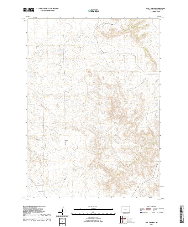
2021 Map of Lone Tree Hill
USGS Topo · Published 2021About this map
Lone Tree Hill serves as the central landmark for this high plains landscape in eastern Wyoming, where the drainage patterns of Muddy Cr and Little Muddy Cr define the rolling topography. The area is characterized by its agricultural and ranching layout, organized strictly by the Public Land Survey System as shown by the township and range lines of t32n r65w and t31n r65w. Human presence is concentrated along solitary corridors like S Jireh Rd, which connects remote homesteads across the section lines. Toward the southern end of the quadrangle, Willow Cr winds through the draws, highlighting the critical importance of seasonal water sources in this arid Niobrara County environment.
Find a feature on this map
9 named features on this map. Tap any name to fly to it.
Don’t see what you’re looking for? This feature index may not catch every label — zoom into the map to look around manually.
Map Details
Editions of this 2021 Lone Tree Hill Map
This is the sole edition of this map. No revisions or reprints were ever made.
Other maps of this area

1949 · Cedar Top
USGS Topo · 1:24,000

1950 · Cedar Top
USGS Topo · 1:24,000

1950 · Prairie View School
USGS Topo · 1:24,000

1954 · Torrington
USGS Topo · 1:250,000

1958 · Torrington
USGS Topo · 1:250,000

1970 · Keeline
USGS Topo · 1:24,000

1974 · Lone Tree Hill
USGS Topo · 1:24,000

1974 · Silver Springs
USGS Topo · 1:24,000
1978 · Meadowdale
USGS Topo · 1:24,000
1978 · Rawhide Buttes West
USGS Topo · 1:24,000