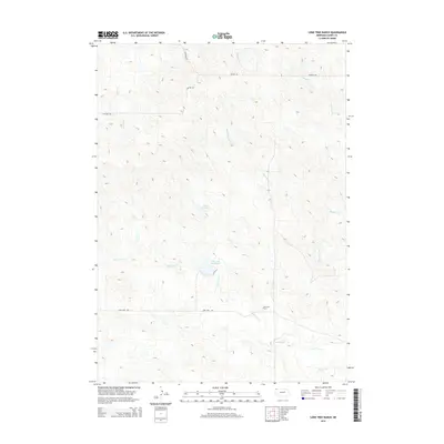
2014 Map of Lone Tree Ranch
USGS Topo · Published 2014About this map
Lone Tree Ranch and its surrounding rangeland dominate this portion of the Nebraska panhandle, where water management is central to the landscape. The geography is defined by a dense network of drainages and intermittent streams, including Lone Tree Cr, Messenger Cr, and Peterson Cr, which feed into vital stock-watering points. Two significant impoundments, Bauer Reservoir and Lone Tree Reservoir, provide reliable water sources in this arid environment. The road network is sparse and functional, consisting primarily of section-line routes like N Wayside Rd and Lone Tree Rd. This 2014 survey illustrates the continued importance of large-scale ranching operations and localized hydraulic infrastructure in maintaining the agricultural viability of Dawes County.
Find a feature on this map
14 named features on this map. Tap any name to fly to it.
Don’t see what you’re looking for? This feature index may not catch every label — zoom into the map to look around manually.
Map Details
Editions of this 2014 Lone Tree Ranch Map
This is the sole edition of this map. No revisions or reprints were ever made.
Other maps of this area

1896 · Oelrichs
USGS Topo · 1:125,000

1900 · Oelrichs
USGS Topo · 1:125,000

1955 · Hot Springs
USGS Topo · 1:250,000

1955 · Alliance
USGS Topo · 1:250,000

1957 · Alliance
USGS Topo · 1:250,000

1958 · Alliance
USGS Topo · 1:250,000

1980 · Horn
USGS Topo · 1:24,000

1980 · Wolf Butte
USGS Topo · 1:24,000

1980 · Lone Tree Ranch
USGS Topo · 1:24,000

1980 · Wayside
USGS Topo · 1:24,000