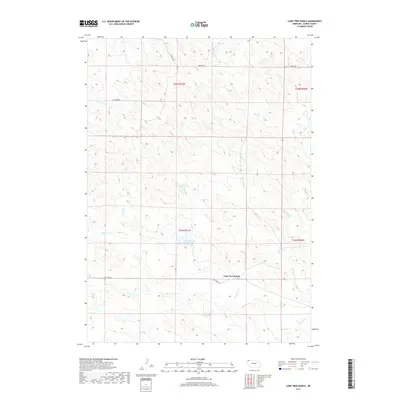
2017 Map of Lone Tree Ranch
USGS Topo · Published 2017About this map
Lone Tree Ranch anchors this landscape in Dawes County, Nebraska, representing the enduring agricultural character of the High Plains. The terrain is defined by a dense network of intermittent drainages, including Messenger Cr, Fisher Cr, and Peterson Cr, which flow through the dissected uplands. These seasonal watercourses are vital to the ranching economy, supplemented by man-made catchments like Bauer Reservoir and Lone Tree Reservoir. The section-line road system, featuring Lone Tree Rd and several branches of Wayside Rd, illustrates the systematic land division of the American West. The survey highlights the spatial relationship between natural hydrology and rural infrastructure, where every creek and reservoir serves the primary namesake ranching operation.
Find a feature on this map
17 named features on this map. Tap any name to fly to it.
Don’t see what you’re looking for? This feature index may not catch every label — zoom into the map to look around manually.
Map Details
Editions of this 2017 Lone Tree Ranch Map
This is the sole edition of this map. No revisions or reprints were ever made.
Other maps of this area

1896 · Oelrichs
USGS Topo · 1:125,000

1900 · Oelrichs
USGS Topo · 1:125,000

1955 · Hot Springs
USGS Topo · 1:250,000

1955 · Alliance
USGS Topo · 1:250,000

1957 · Alliance
USGS Topo · 1:250,000

1958 · Alliance
USGS Topo · 1:250,000

1980 · Horn
USGS Topo · 1:24,000

1980 · Wolf Butte
USGS Topo · 1:24,000

1980 · Lone Tree Ranch
USGS Topo · 1:24,000

1980 · Wayside
USGS Topo · 1:24,000