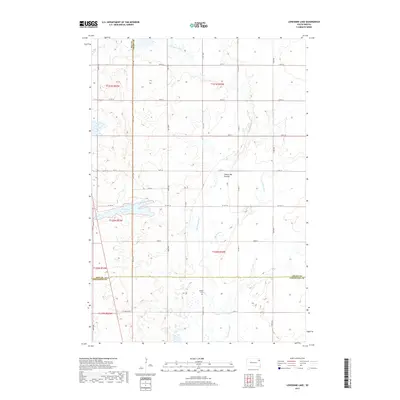
2017 Map of Lonesome Lake
USGS Topo · Published 2017About this map
Coteau des Prairies, a vast highland plateau, defines the landscape of this region where three South Dakota counties converge. The glacial topography is marked by significant hydrological features, most notably the Big Sioux River and the Indian River as they wind through the agricultural sections of t121n r52w and t120n r52w. Near the center of the map, Lonesome Lake sits as a prominent natural landmark amidst the section-line road grid. For those researching local heritage, the inclusion of Bergen Cem south of Co HWY 14 provides a specific point of interest for genealogical study within this prairie landscape. The map meticulously documents the transition of county lines between Day, Grant, and Codington counties.
Find a feature on this map
26 named features on this map. Tap any name to fly to it.
Don’t see what you’re looking for? This feature index may not catch every label — zoom into the map to look around manually.
Map Details
Editions of this 2017 Lonesome Lake Map
This is the sole edition of this map. No revisions or reprints were ever made.
Other maps of this area

1953 · Milbank
USGS Topo · 1:250,000

1958 · Milbank
USGS Topo · 1:250,000

1970 · Summit
USGS Topo · 1:24,000

1970 · Lonesome Lake
USGS Topo · 1:24,000

1970 · Still Lake SE
USGS Topo · 1:24,000

1970 · Waubay
USGS Topo · 1:24,000

1970 · Florence NE
USGS Topo · 1:24,000

1970 · Ortley
USGS Topo · 1:24,000

1970 · Still Lake NE
USGS Topo · 1:24,000

1970 · Still Lake
USGS Topo · 1:24,000
Featured Places
- Germantown Township, SD
- Enemy Swim District, SD
- Dexter Township, SD
- Codington County, SD
- Grant County, SD