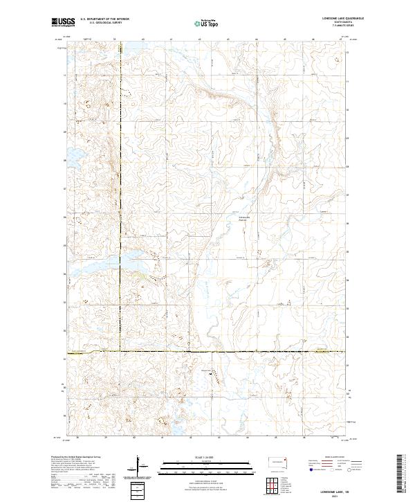
2021 Map of Lonesome Lake
USGS Topo · Published 2021About this map
Coteau des Prairies, a vast upland plateau, dominates this landscape where the borders of Grant, Day, and Codington counties meet. The drainage pattern is defined by the winding course of the Big Sioux River and the Indian River, which meander through a series of prairie potholes and wetlands typical of this glacial region. Near the center of the sheet, Lonesome Lake sits as a prominent natural landmark, surrounded by a grid of rural section roads like Co Hwy 14 and 151st St. Cultural markers are sparse in this agricultural expanse, but the Bergen Cem remains a significant point of interest for genealogists and local historians. The map clearly delineates the complex township and range system, including t120n r52w, illustrating the geometric precision of the Public Land Survey System in eastern South Dakota.
Find a feature on this map
26 named features on this map. Tap any name to fly to it.
Don’t see what you’re looking for? This feature index may not catch every label — zoom into the map to look around manually.
Map Details
Editions of this 2021 Lonesome Lake Map
This is the sole edition of this map. No revisions or reprints were ever made.
Other maps of this area

1953 · Milbank
USGS Topo · 1:250,000

1958 · Milbank
USGS Topo · 1:250,000

1970 · Summit
USGS Topo · 1:24,000

1970 · Lonesome Lake
USGS Topo · 1:24,000

1970 · Still Lake SE
USGS Topo · 1:24,000

1970 · Waubay
USGS Topo · 1:24,000

1970 · Florence NE
USGS Topo · 1:24,000

1970 · Ortley
USGS Topo · 1:24,000

1970 · Still Lake NE
USGS Topo · 1:24,000

1970 · Still Lake
USGS Topo · 1:24,000